skip to main |
skip to sidebar
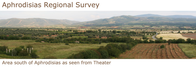
Aphrodisias Regional Survey Repository
Aphrodisias Regional Survey Repository
Aphrodisias
is one of the most important archaeological sites of the Greek and
Roman periods in Turkey, famous in antiquity for its sanctuary of
Aphrodite and its virtuoso sculptors. Excavations at Aphrodisias have
been carried out by New York University since 1961 and have revealed an
unusually well-preserved and picturesque ancient town, which makes an
indelible impression on visitors and brings the civic culture of the
Graeco-Roman world vividly to life.
Until recently, however, modern knowledge of ancient Aphrodisias
extended only as far as the city’s fortification walls. Very little
attention had been paid to the monuments outside the gates—beginning
with the suburban roads and cemeteries—or to the study of the
relationship between the urban settlement and its rural environs.
Although the excavations had revealed one of the world’s best-preserved
ancient cities, important questions about the history of the city had
remained unanswered.
The Aphrodisias Regional Survey was begun in 2005 in order to
investigate the interaction between human habitation and the natural
environment in an 800-square-kilometer area around Aphrodisias from
prehistory to the present day, especially in the Hellenistic and Roman
periods. Major fieldwork combining intensive and non-intensive
archaeological survey and geological and geographical investigation was
completed in 2009. Approximately 700 archaeological points of interest
have been recorded and entered into a Geographical Information System
(GIS), including tombs, farmsteads and settlements, caves, wine and
olive oil presses, quarries, aqueducts and cisterns, rural sanctuaries
and churches, and a network of fortified citadels and hilltop
watchtowers. The work has been sponsored by New York University and the
University of Michigan, with major financial support from the Leon Levy
Foundation.
The excavations at Aphrodisias have made significant contributions to
the history of the ancient Mediterranean city. Regional survey has
extended our knowledge of the site in both time and space--providing new
information about Aphrodisias and environs before and after the heyday
of the city and illuminating the interaction between town and
countryside in numerous ways.
The results of the Aphrodisias Regional Survey have been published in C. Ratté and P.D. De Staebler, eds., Aphrodisias V. The Aphrodisias Regional Survey
(Verlag Philipp von Zabern: Darmstadt/Mainz, 2012). The purpose of the
present collection is to provide electronic access to: (1) the entire
catalogue of archaeological points of interest recorded by the survey;
the complete photographic archive; high-resolution scans of all the
hand-drawn architectural drawings; high-resolution versions of all the
digital maps and plans; (2) the entire catalogue of all the contexts
targeted for systematic collection of surface finds; and (3) the entire
intensive (transect) survey database, including all the data recorded
for each subtransect of the survey. For an explanation of the
organization of the databases and of the basic survey methods, see Aphrodisias V, pages 16-21.
The main survey database (1) may be accessed from this page. It consists
of individual records for each archaeological point of interest, with
thumbnail links to relevant images, together with individual records for
each of the maps summarizing the results of the survey. The maps may be
found by searching for the word “Map” in the title of the record. The
context (2) and transect (3) databases may be downloaded by clicking on
the following links:
Aphrodisias Regional Survey Context Database and Aphrodisias Regional Survey Transect Database.


 Stumble It!


No comments:
Post a Comment