Showing posts with label kml. Show all posts

Saturday, March 26, 2022

ANE Placemarks for Google Earth

[First posted in AWOL 26 July 2011, updated 26 March 2022]

Pedersen, Olof

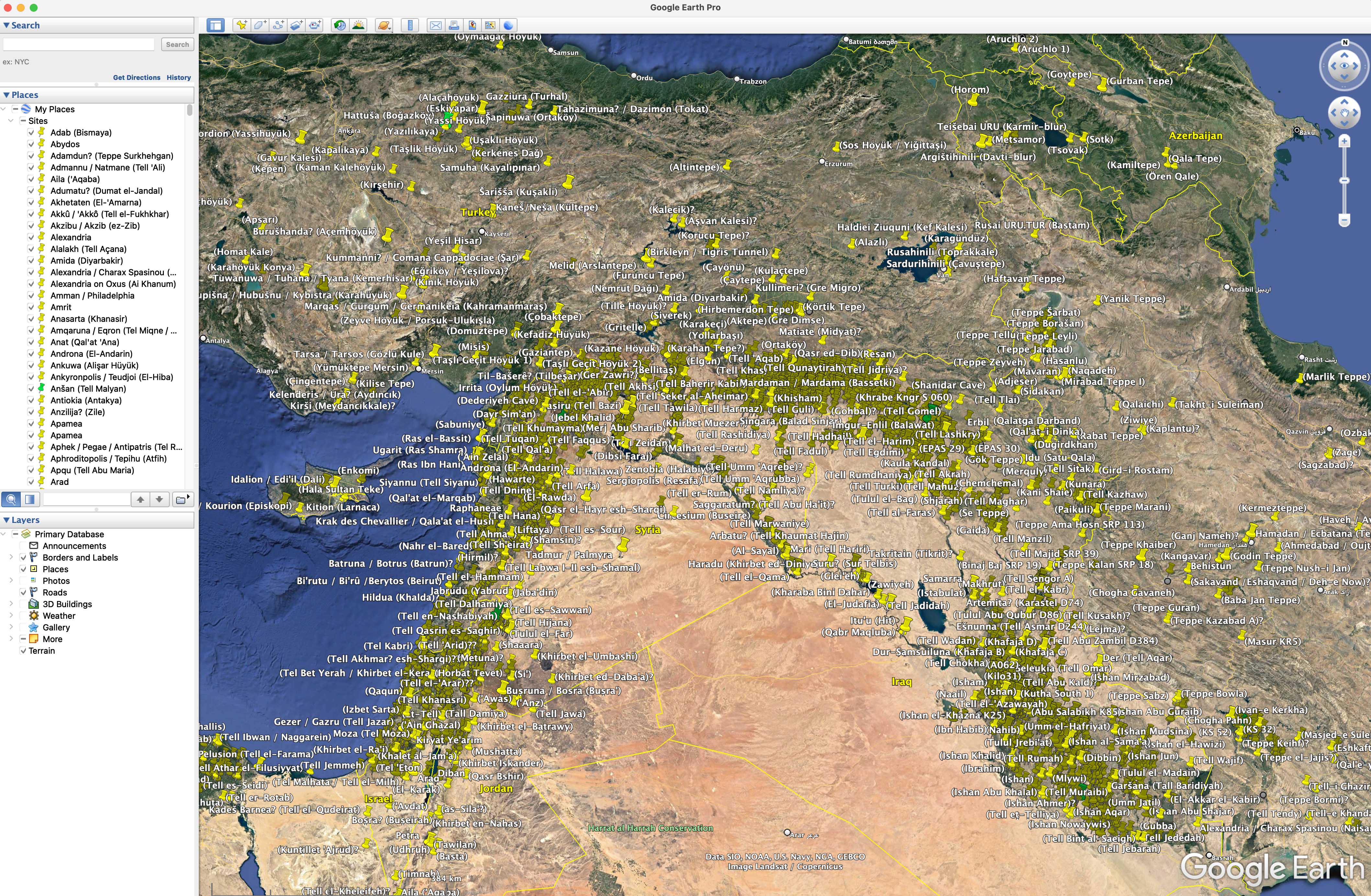
ANE.kmz is a set of site placemarks for Google Earth of a selection of the most important archaeological sites in the Ancient Near East. ANE.kmz works with Google Earth Pro, which first has to be downloaded for free. When opened inside Google Earth Pro, ANE.kmz gives, to the left, an alphabetic list of ancient sites and, to the right, on the satellite images the same sites marked. For the moment, there are some 2500 sites with modern names; among them some 400 have ancient names. Additions of more sites are planned. Ancient names are written without parenthesis. Modern names are within parenthesis. Most sites have been identified on the satellite images.

ANE Waters.kmz is an experimental set of provisional water placemarks for Google Earth covering Mesopotamia up to modern time.

ANE Picture.jpg is just illustrating the appearence of ANE.kmz before zooming in and is not for use.

The development started in 2007 with support from Uppsala University, the Urban Mind Project at Mistra, and the Excellence Cluster Topoi at Freie Universität Berlin. Early versions were hosted by Uppsala University servers.
Files (2.8 MB)
Name Size
ANE Picture.jpg
md5:a08351193be6a503748e73654faa149c
1.9 MB
ANE Waters.kmz
md5:3c1c92ccb6324e01d9a882dbc24a89c5
460.3 kB
ANE.kmz
md5:3c46cf4f2595fe86a1ceaa2146a21c09
390.4 kB


And see AWOL's Roundup of Resources on Ancient Geography

Monday, September 14, 2015

2300 Ancient Sites on Google Earth

[First posted in AWOL 1 November 2011, updated (the original of the first link is gone, AWOL now links to the version at the Wayback machine - the site list and kml file links remain accessible) 14 September 2015]

From Bill Thayer and Jona Lendering at New at LacusCurtius & Livius:
 
2300 Ancient Sites on Google Earth
http://www.livius.org/a/libya/bu_njem/bu_njem_satellite_s.jpg
On several occasions I have blogged on the possibilities of Google Earth and its online spin-off, Google Maps. My last blog on this topic was a bit over half a year ago, when I had some 1700 items available. In the meantime, I have added more than 550 ancient sites to my list, from all quarters of the ancient world.

The online version is here and the masterfile can be downloaded here. If you use the latter, do not forget the directory NEW/OFF-TOPIC, which contains many others, still unqualified markers.

Wednesday, January 11, 2012

The Archaeological Sites of the Aegean Minoans

The Archaeological Sites of the Aegean Minoans
The Aegean Minoan 3D GIS Project was initiated in 2007 to produce a three-dimensional (3D) full-color mapping of the archaeological sites of the Minoans in the Aegean Sea area using Google Earth. It is intended to be a definitive geographical reference available to everyone. While this is an ongoing project and we are always looking to improve it, thanks to the many contributing scholars and volunteers it is by far the most comprehensive and accurate mapping of its kind ever made and includes the sites and geographical features listed below.

Minoan Miniature Frieze Admirals Flotilla Fresco Shipping Scene Restoration
Late Bronze Age (LBA), Neo-Palatial Period
Akrotiri, Santorini (Thera), Greece.
All sites are referenced to the scientific literature and have links to additional descriptive and visual information wherever possible with some exceptions. 3D virtual reality panoramas like Bruce Hartzler's Metis QTVR catalog and the British School at Athens' 3D virtual reality tour of Knossos are included. I want to express my great thanks for the kind generosity of all the contributors who are to be congratulated for making this possible. As always I would appreciate any additions, corrections, comments, or suggestions that anyone may have.

W. Sheppard Baird

Minoan Depiction of the Ringed Islands of Thera
Akrotiri Miniature Frieze "Flotilla" Closeup Restoration
Late Bronze Age (LBA), Late Minoan I Period
The West House, Room 5, South Wall
Akrotiri, Santorini (Thera), Greece.
Instructions
If you alresdy have Google Earth setup on your computer all you need to do is download the GIS mapping below but if not you will need to download the free version here:
With Google Earth downloaded, installed, and working properly on your computer you are now ready to download the GIS mapping file:
Once downloaded simply open it and Google Earth will automatically start up and display the mapping from a great elevation. New users can grab the map and move it anywhere they wish by holding down the left mouse button. There are three controls on the upper right pf the screen. The top one is for tilting and rotating. The middle one is for panning and the bottom slider is for zooming in and out. Just position an area of interest in the center of the screen and zoom in to see the map's detail. The latitude, longitude, and elevation of your mouse position is displayed on the bottom center of the screen. The numbers shown on the right of some list entries below are elevations in meters...

Sunday, October 23, 2011

AIA's new Archaeology of America and Canada on Google Earth

Google Earth's New Layer: Archaeological Sites in the United States and Canada October 22, 2011 
 
Google Earth's New Layer: Archaeological Sites in the United States and Canada 
Explore the AIA's new Archaeology of America and Canada on Google Earth. (If you do not have it installed, please download Google Earth.)

"Having this Google Earth map debut on National Archaeology Day emphasizes the fact that archaeological discoveries often times exist right in our backyards," says Ben Thomas, AIA's Director of Programs. "We welcome everyone of all ages to take a look at the map and then explore a site that's close to them."

Thanks to our partners at Google Earth for making this possible!

Archaeology of America and Canada