Showing posts with label Visualization. Show all posts

Tuesday, November 18, 2025

The Virtual Mummy: Unwrapping a Mummy by Mouse Click

[First posted in AWOL 29 November 2014, updated (new URLs) 18 November 2025]

The Virtual Mummy: Unwrapping a Mummy by Mouse Click

The VIrtual Mummy

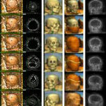
The computer has entered our everyday life and did not stop before the field of mummy research. It helps researchers not only in the non-destructive examination of mummies, but even allows the creation of a “virtual mummy”, which visitors of the exhibition The Secret of the Mummies – Eternal Life at the Nile, but also you (with limited functionality) can unwrap on the screen. The object is a 2300-year-old mummy of a female, aged about 30 years.


Friday, August 9, 2019

Babylon 3D

Babylon 3D

http://www.kadingirra.com/images/header_pic.jpg
Reconstruction of the ancient city of Babylon was created by me between March and May of 2013 for the Mesopotamia exhibition of the Royal Ontario Museum. See ROM webpage for more information. 

As there are more than enough textual, but not enough visual material on the web, this site will consist mostly of visuals.


INTRODUCTION

CITY PLAN

BABYLON

PALACES

ETEMENANKI

TEMPLES

HANGING GARDENS

PROCESSION STREET

GATES

WALLS

CONTACT

Sunday, May 26, 2019

Palmyra GIS

Palmyra GIS
 Palmyra GIS
A group for data exchange on Palmyra/Syria. Members of this group can view and download data.
 Data
Layers
Documents
Maps

Wednesday, September 26, 2018

Piggin's Library of Latin Diagrams

Piggin's Library of Latin Diagrams

Presentation Rules

This style guide is all about how visual browsers can display different genres of text for the greatest readability. Its focus is on the architecture of information, and useful ways to categorize and label it as early as possible when building a site.
The emphasis here is on the macro-typography, the sort of thing that people who code HTML call "block-level" content, such as paragraphs, lists, tables and headings, but some attention will also be paid to micro-typography.
The distinction between micro- and macro-typography was popularized by the book designer Jost Hochuli and is now a commonplace in the German-speaking countries. Whereas micro-typography involves lettering— designing, choosing and mixing fonts, spacing letters and punctuating words— macro-typography is the business of laying out bodies of text in logical and pleasing patterns: distributing blank space, choosing colours and conveying meaning by proper arrangement.
We rarely give thought to the role of presentation as a conveyor of meaning, yet we expect in almost every act of reading that certain rules will be respected: that paragraphs will group together ideas; that a change of speaker in a dialogue will be marked by starting on a new line; that items in a list will be logically parallel to one another.
We see and draw meaning from presentation before our eyes can even resolve the individual words. Cast onto a table, a letter is usually recognizable from 10 metres away for what it is: the salutation and signature have a certain standard location, and when we pick up the letter in our hands, they provide the entry points with which we usually begin: to whom? from whom?
1 2 3 4 5

Introduction
Poetry
Footnotes
Glosses
Deeds
History

Antiquity

Saturday, September 16, 2017

Digitales Forum Romanum

[First posted in AWOL 18 September 2017, updated 16 September 2017]

Digitales Forum Romanum
http://www.digitales-forum-romanum.de/wp-content/uploads/2014/02/Phase-L_Viewpoint-BeckOst13-760x338.jpg
deutsch – english – italiano
Forschungs- & Lehrprojekt des Winckelmann-Instituts der Humboldt-Universität zu Berlin
in Kooperation mit dem Exzellenzcluster TOPOI


Das antike Forum Romanum gehört zu den Hauptattraktionen eines jeden Rombesuchs. Täglich erkunden hunderte von Besuchern das Forum Romanum und lassen sich von der stimmungsvollen Ruinenlandschaft und der historischen Bedeutung dieses Ortes faszinieren: Hier lag das öffentlich-politische Zentrum der antiken Metropole, hier wurde Politik gemacht und Geschichte geschrieben – und entsprechend pulsiert hier für uns heutzutage die Vergangenheit des antiken Roms in einer ganz besonderen Intensität. Doch angesichts der idyllischen Ruinenlandschaft, als welche sich die Ausgrabungsstätte heutzutage präsentiert, fällt es schwer, sich ein wirkliches Bild von diesem antiken Platz zu machen: Wie erlebten ihn die Menschen in der Antike, wie präsentierte er sich als Bühne des politischen Handelns und der gesellschaftlichen Kommunikation, und wie funktionierte er überhaupt konkret als öffentliches Zentrum dieser einzigartigen antiken Metropole? Es sind diese Fragen, mit denen die Ausgrabungsstätte ihre Besucher oftmals alleine lässt. Und es sind die Fragen, auf die wiederum die Klassische Archäologie seit jeher mit Hilfe von Rekonstruktionen Antworten zu geben versucht.

  • Start
  • Forum Romanum
  • Projekt
  • Ressourcen
  • Multimedia
  • Kontakt

  • Thursday, April 13, 2017

    Le plan de Rome: Restitue la Rome antique

    Le plan de Rome: Restitue la Rome antique
    http://www.unicaen.fr/services/cireve/rome/images/headerEssai8noir.jpg
    Le Plan de Rome est une grande maquette en plâtre de près de 70 m² qui représente la Rome antique au temps de l'empereur Constantin (IVe s. apr. J.-C.). Classé à l'Inventaire des monuments historiques, il est l'œuvre de l'architecte normand Paul Bigot (1870-1942), Grand Prix de Rome en 1900 et Professeur à l'Ecole des Beaux-Arts de Paris. Légué à l'université de Caen et exposé aujourd'hui au cœur de la Maison de la Recherche en Sciences Humaines, ce plan-relief est à l'origine d'un projet pluridisciplinaire de maquette virtuelle 3D reconstituée en images de synthèse...

    Tuesday, March 7, 2017

    Mekhane

    Mekhane
    http://www.mekhane.com/images/bg.jpg
    Mekhane in Ionic Greek means essentially contrivance, engine, 'machine'. Here it is used as the domain name for a digital map of visualizations about the ancient world. It focuses on gathering the following information about visualizations:

  • Technological tools
  • Purpose
  • Ancient places
  • Contemporary site of production
  • Geographical density
  • International impact

  • It is, in short, a research and a study tool for visualizations of ancient sites, buildings and environments.

    Wednesday, February 22, 2017

    AKDC debuts new data visualization tool: Layer Cake

    AKDC debuts new data visualization tool: Layer Cake
     
    The Aga Khan Documentation Center at MIT has released its prototype of Layer Cake, a 3-axes mapping tool that enables users to build maps layering narrative, time, and space simultaneously. Envisioned by AKDC Program Head, Sharon C. Smith, Ph.D., the tool has become a reality thanks to the programming expertise of James Yamada (Master in Design Studies, Harvard GSD).

    Ali Asgar Alibhai (Ph.D. candidate, Harvard NELC) provided the content for the pilot project by analyzing textual sources of Ibn Jubayr’s 12th century pilgrimage from  Spain to Mecca.  The resulting map documents Ibn Jubayr’s travels temporally, geographically, and with accompanying descriptions of the cities and sites he visited.  Images and information about those cities and sites is linked to Archnet–AKDC’s globally-accessible, intellectual resource focused on architecture, urbanism, environmental and landscape design, visual culture, and conservation issues related to the Muslim world–to provide more context.

    While James, Ali, and Sharon continue to develop the tool and refine the interface, we welcome users to view Ibn Jubayr’s travels in Layer Cake and provide feedback for this test case.  Please send questions, comments, and suggestions to the project PI, Sharon C. Smith.

    Wednesday, January 18, 2017

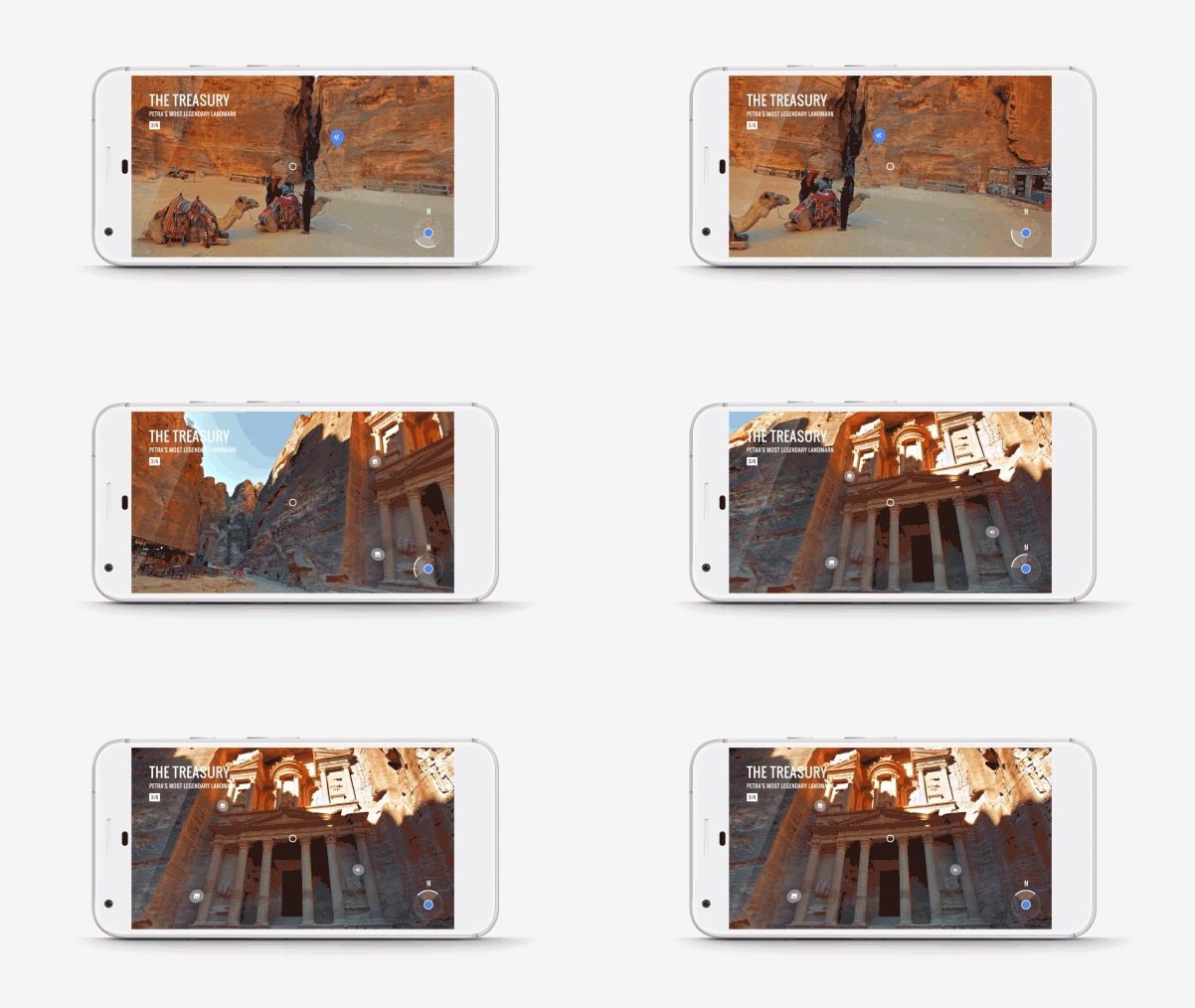
    A virtual trek through Petra with Google Cardboard

    A virtual trek through Petra with Google Cardboard

    Monday, January 16, 2017

    Free online course: Rome: a Virtual Tour of the Ancient City

    Rome: a Virtual Tour of the Ancient City
    Explore the architecture and history of Rome, walking around a 3D digital model of the ancient city, with this free online course.
    https://ugc.futurelearn.com/uploads/images/5c/c2/promo_large_5cc27180-a3b0-4adb-894f-a4f01d954318.jpg
    About the course 
    Take a guided tour around ancient Rome with University of Reading expert, Dr Matthew Nicholls, using his detailed, historically accurate and award-winning, 3D digital model of this awe-inspiring city.

    Immerse yourself in the architecture and history of Ancient Rome

    Join Matthew on a walk around the city of Rome, and ask yourself:
    Why was this ancient city built where it was? Did all roads really lead to Rome? How was drinking water supplied to the city’s million inhabitants? Where did Romans worship their gods and meet their political masters? And which buildings provided a backdrop for the spectacular events that both celebrated emperors and secured the loyalty of the masses?
    The course will encourage you to explore the answers to all of these questions and many more. It combines excerpts and ‘virtual walk around’ views of the 3D digital model with timelines, animations and 360 degree panoramic images. Moving seamlessly between the digital model and real-life film footage of contemporary Rome, Matthew brings the ancient city to life as never before.
    By the end of the course, you will:
    • be familiar with the topography, architecture, and political and social history of ancient Rome;
    • understand how experts study these topics and what they use as source material to gain an accurate insight into the past;
    • and better understand and interpret the archaeological ruins that you might encounter, for example, on holiday in Rome.

    Learn with a Roman history expert from the University of Reading

    Throughout the course, you will learn with Dr Matthew Nicholls, a recognised expert on ancient Rome. Matthew has extensive broadcast and public speaking experience on Roman history, and directs a specialist Masters degree on the ancient city in the Department of Classics at the University of Reading.

    Requirements
    This course is open to anyone with an interest in discovering more about ancient Rome. You might be: planning a visit to the Italian capital; an avid watcher of documentaries on Roman history; or considering studying archaeology, classics or history at university.

    Friday, December 30, 2016

    Ancient Jerusalem in VR app

    Ancient Jerusalem in VR app
    Our first app, Ancient Jerusalem in VR, is available for download on Google play! The app allows users to experience ancient Jerusalem, as it was 2,000 years ago, from four vantage points. Here’s everything you need to know about each of them! Click here to download the app and experience this ancient wonder for yourself.
    Modern street level
    You are on a 15m column in front of the Temple’s Western Wall. This is the current ground level when you visit the site today. You are surrounded by domestic housing. To your left is Wilson’s Arch and a bridge that gives access to the temple complex. Behind the observer are views of the surrounding landscape including distant glimpses of the fortification wall and residential areas. The remains of the fortification wall are scant in modern Jerusalem, so a reconstructed version is used here based on chronologically parallel examples...


    Thursday, August 18, 2016

    CHER-Ob: An Open Source Platform for Shared Analysis in Cultural Heritage Research

    CHER-Ob: An Open Source Platform for Shared Analysis in Cultural Heritage Research
    CHER-Ob Screenshot
    CHER-Ob (CULTURAL HERITAGE-Object) is an open source platform developed in an attempt to enhance analysis, evaluation, documentation, sharing and management of 3D and 2D visualizations as well as textual and conservation science data.
    Introduction
    The development of CHER-Ob is intended to offer a flexible, expandable integrated platform for collaborative cultural heritage research. It is compatible with commonly used imaging data types (2D and 3D images, RTIs, CT) and textual information. CHER-Ob offers an enhanced annotation framework and metadata schema, automatic report generation, bookmark, screenshot, searching, sorting and filtering options.
    For a quick into to CHER-Ob please see the quick guide. for a detailed explanation of the features see manual.  You can also download the sample projects to further explore the software.
    The source code can be found in Github (http://github.com/WeiqiJust/CHER-Ob).

    CHER-Ob was developed by the Yale Institute for the Preservation of Cultural Heritage in collaboration with Yale Computer Graphics Group through a generous grant from the Seaver Foundation.

    Saturday, April 30, 2016

    ICONEM's digitalized 3D model of the Temple of Bel, Palmyra, post destruction

    ICONEM's digitalized 3D model of the Temple of Bel, Palmyra, post destruction
    https://d35krx4ujqgbcr.cloudfront.net/avatars/77e89a8925aa4f069f762e441687c23e/f00fdd48135a4ab89b4efdd7ba61e569.jpeg
    In partnership with the DGAM, the ICONEM’s team was the first one to be in Palmyra since Daesh’s departure. New phase of the major project « Syrian Heritage », this mission has been an opportunity to give a clear picture of the damages suffered by the « pearl of the desert », and more specifically by the Temple of Bel as it has been left behind by Daesh fighters, using photogrammetry. 

    The digitalized 3D model allows us to observe the existence of stone blocs remaining almost intact, meaning that there might be some hope for a partial reconstruction. Some other blocs however have been dynamited. 

    ICONEM’s support in Palmyra has been found essential in order to document the appearance and state of the site right after it’s liberation, which is going to be helpful to the scientific community. Dedicated in 32 AD and consecrated to the protective divinity of Palmyra, the Mesopotamian god Bel, the Temple of Bel was before its destruction one of the best preserved antique temples of Syria.

    Monday, April 25, 2016

    Conflict Urbanism Aleppo

    Conflict Urbanism Aleppo
    Conflict Urbanism: Aleppo is a project in two stages.

    First, we have built an open-source, interactive, data-rich map of the city of Aleppo, at the neighborhood scale. Users can navigate the city, with the aid of high resolution satellite imagery from before and during the current civil war, and explore geo-located data about cultural sites and urban damage. We will add data as it becomes available; currently we are grateful for datasets from from Human Rights Watch, the United Nations Operational Satellite Applications Programme (UNOSAT), and the Humanitarian Information Unit (HIU) at the U.S. Department of State.

    Second, the map is a platform into which additional data of all sorts can be integrated. It is an invitation to students and invited collaborators to record and narrate urban damage in Aleppo — at the cultural, infrastructural, or neighborhood scale — and to present that research in case studies which will be added to the website over time.

    We invite ideas and propositions, and hope to build on the data that we have compiled here to develop further research on and engagement with the situation in Aleppo. It is a call for inquiry and a call to action.

    Since 2012, the people of Aleppo — one of the oldest continuously-inhabited cities in the world — have been exposed to catastrophic violence. Many thousands have been injured, died, or fled. Our project focuses on their city and what has been done to it and what might happen to it in the future.

    Wednesday, April 6, 2016

    Panoply - a space devoted to helping you enjoy, teach, and research the ancient world

     [First posted in AWOL 18 April 2013, updated (all new website) 6 April 2016]

    Panoply Vase Animation Project
    Welcome to Panoply, a space devoted to helping you enjoy, teach, and research the ancient world.  See Steve Simons’ amazing animations bring ancient Greek vase scenes to life; discover new ways to use animation; find out about Sonya Nevin’s research; and follow our blog for up-to-date news on events, progress, and interviews.
    Steve has been making vase animations since 2007.  With a history in software engineering, Steve studied multimedia design before becoming a freelance animator.


    Sonya did her doctorate on ancient Greek warfare at University College Dublin.  She is now a research fellow and visiting lecturer at the University of Roehampton in London.  She has worked and volunteered in the Ure Museum, the UCD Classical Museum, and the Royal Museums Greenwich.  Sonya’s research and teaching interests include religion, warfare, and historiography.


    Tuesday, March 22, 2016

    REVIVAL: Technological support for Syrian heritage

    REVIVAL: Technological support for Syrian heritage
    Iconem's ambition is to preserve the knowledge of threatened heritage using digital advances. Thanks to our ground surveys and our visual processing algorithms, we are able to produce real digital doubles of archaeological remains or expanses. We hence offer the scientific community and the public an innovative means of exploring famous places of world heritage.

    For sites under threat of disappearance, our technology guarantees that, whatever happens, the archaeological knowledge will be preserved.  By scanning today the sites which are under threat of disappearance tomorrow, we are working to preserve a common asset and we are ensuring its transmission to future generations.

    Syrian culture is our common heritage. We are losing it. What can we do to preserve this culture for future generations? Documentation can't wait! Iconem sends specialists to support Syrian archaeologists and architects by providing them with advanced techniques to document their heritage. We organise missions in the field using the latest technology in order to create a digital database of Syrian monuments and a national team able to provide data for it. Because saving the knowledge of this history is our common duty.

    التراث الثقافي السوري هو تراث مشترك للجميع. إننا نخسره! ماذا يمكن أن نفعل للحفاظ على هذه الثقافة للأجيال القادمة؟ إنّ إجراء التوثيق لا يمكن أن ينتظر! تتولى إيكونيم إرسال متخصصين لدعم علماء الآثار والمعماريين السوريين من خلال تزويدهم بمعدات حديثة لتوثيق تراثهم. إننا نقوم بتنظيم بعثات ميدانية مجهزة بأحدث التكنولوجيا بهدف إنشاء قاعدة بيانات للآثار السورية، وتكوين فريق وطني قادر على تغذيتها. لأن إنقاذ معرفة هذا التاريخ هو واجبنا المشترك.

    Sunday, February 28, 2016

    ANCIENT ROME LIVE: A new way to learn about Rome's past

    ANCIENT ROME LIVE: A new way to learn about Rome's past

    Ancient Rome Live

    Rome’s enduring contribution to world civilization can, and should, be communicated in a way that combines the hard facts, solid reasoning, and new discoveries of university research with the excitement and immediacy of on-location filming in Rome. If a picture is worth a thousand words, then a video is worth a million.

    Ancient Rome Live (ARL) is an immersive journey that provides new perspectives about the ancient city. A multi-platform learning experience, ARL first and foremost presents original content:

    • a clickable map of ancient Rome
    • a library of videos arranged according to topic
    • live streaming from sites in Rome and her empire.
    ARL provides an interactive platform to engage the many layers of Rome: monuments, people, places, and events.  Ancient Rome Live  is a valuable resource for teachers- and a lot of fun for anyone interested in history.

    Later in 2015 ARL will release an ebook, app, and free online course.   WIth all of these new, coordinated formats, ARL will change the way ancient Rome is studied.

    Darius Arya, Archaeologist and TV host, Founder, director, producer

    Albert Prieto, Archaeologist, Chief film and editing
    Mark Brewer, Zagara Films, Film and editing
    Andrea Troiani, Animator
    Darbouze & Daughters, Digital Creative

    Friday, December 4, 2015

    The Theatre of Pompey

    The Theatre of Pompey
    http://www.pompey.cch.kcl.ac.uk/imgaes/proj_logo.gif
     The Theater of Pompey stood on the southern section of ancient Rome’s Campus Martius, the Field of Mars. As its name suggests, in the period when the Senate ruled Rome (the “Republic,” 509 B.C.–  31 B.C.), this largely empty space was the site where the Roman citizen army assembled before marching out against the city’s enemies, and its chief topographical features (marshes, streams, a sizeable lake) did not encourage extensive construction.

    But, by the late second century B.C. some buildings were  already  beginning to go up, and after Pompey, the conqueror of Asia Minor (Turkey) and Syria, constructed his massive  theater, in 55 B.C., the whole area developed rapidly. By the early second century A.D., private citizens and the emperors had filled the entire zone with elegant public and private buildings.


    Wednesday, October 21, 2015

    New Palmyra: Modeling Past the Future

    New Palmyra: Modeling Past the Future
    http://www.newpalmyra.org/sites/default/files/styles/featured_project_slider/public/freebassel-palmyra-04.jpg?itok=1dJFpbYn
    Today, the #NEWPALMYRA project launched a new online community platform and data repository dedicated to the capture, preservation, sharing, and creative reuse of data about the ancient city of Palmyra.
     The organization issued an open call for historical data and artistic work to virtually reconstruct Palmyra’s cultural heritage. The collected data will be released into the public domain under a Creative Commons Zero license at NewPalmyra.org.

    “For millennia, the ancient Syrian city of Palmyra was a vital crossroads of trade and culture. We are hearing the senseless destruction of this archeological treasure by ISIS as a clarion call for the world to celebrate the cultural heritage of Syria,” said Barry Threw, Executive Director of #NEWPALMYRA. “By sharing data and encouraging its use in creative explorations we hope to promote cultural understanding."

    The archives will launch with models based on the 3d virtual reconstruction of Palmyra started by Bassel Khartabil, a Damascus-based technologist and community organizer, and originator of #NEWPALMYRA. “Palmyra is the most important archeological site in Syria,” says Khartabil, “We hope that by honoring its memory with a virtual site of collaboration we can build a new community and highlight the plight of the Syrian people.”

    “Bassel is proving yet again that by digitally preserving Palmyra he was far ahead of the curve. ISIS has committed crimes against humanity, deleting the archives upon which our modern civilizations are based,” said Jon Phillips, leader of the #FreeBassel campaign. "The #NEWPALMYRA project picks up Bassel's work and amplifies it through collaboration with international partners."

    Through its international affiliates, #NEWPALMYRA will source archeological and historical data, share it with the community, and output art exhibitions, salons, and creative works using this data to carry the rich history of Palmyra forward to new generations.

    Call for Participation

    Join us in making #NewPalmyra reality. We're looking for contributors of all sorts: 3D modelers, archaeologists, artists, curators, developers, educators, journalists, researchers, wikimedians. You can do now:
    • Meet us in Paris Oct 30-31 at the #ProtoCultural #NewPalmyra hackfest
    • Talk to us realtime, #newpalmyra on freenode IRC
    • Issues, code, data in our GitHub projects
    • Email us info@newpalmyra.org
    • Follow us and spread the word on our Facebook, Instagram, Twitter
    • Subscribe to our email newsletter
    • Contribute info and media about Palmyra to Wikimedia Commons, Wikipedia, etc; we freely use these materials and will contribute more back.