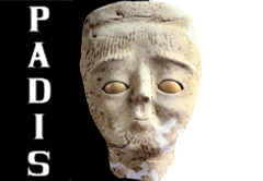
PADIS: Palestine Archaeological Databank and Information System
A tool for protection, study and valorization of the Archaeological Heritage of Palestine
- A coherent organization of archaeological and topographical data from Palestine.
- An interactive databank created to prompt the safeguard of archaeological and historical sites and as scientific and practical tool for the protection, study and cultural valorization.
- A database including satellite images, aerial photos, excavation photos, topographic maps, and updated bibliographic references, expandable with the cooperation of Palestinian scholars and institutions.


 Stumble It!


The correct link to the new PADIS version is: http://www.lasapienzatojericho.it/padis
ReplyDeleteThanks archeologo, but the link you give requires a user name and password. Is PADIS no longer open access?
ReplyDelete-Chuck-
Finally, I'm proud to announce you the website is online and free to access: http://www.lasapienzatojericho.it/padis
ReplyDelete