[First posted in AWOL 26 July 2011, updated 26 March 2022]
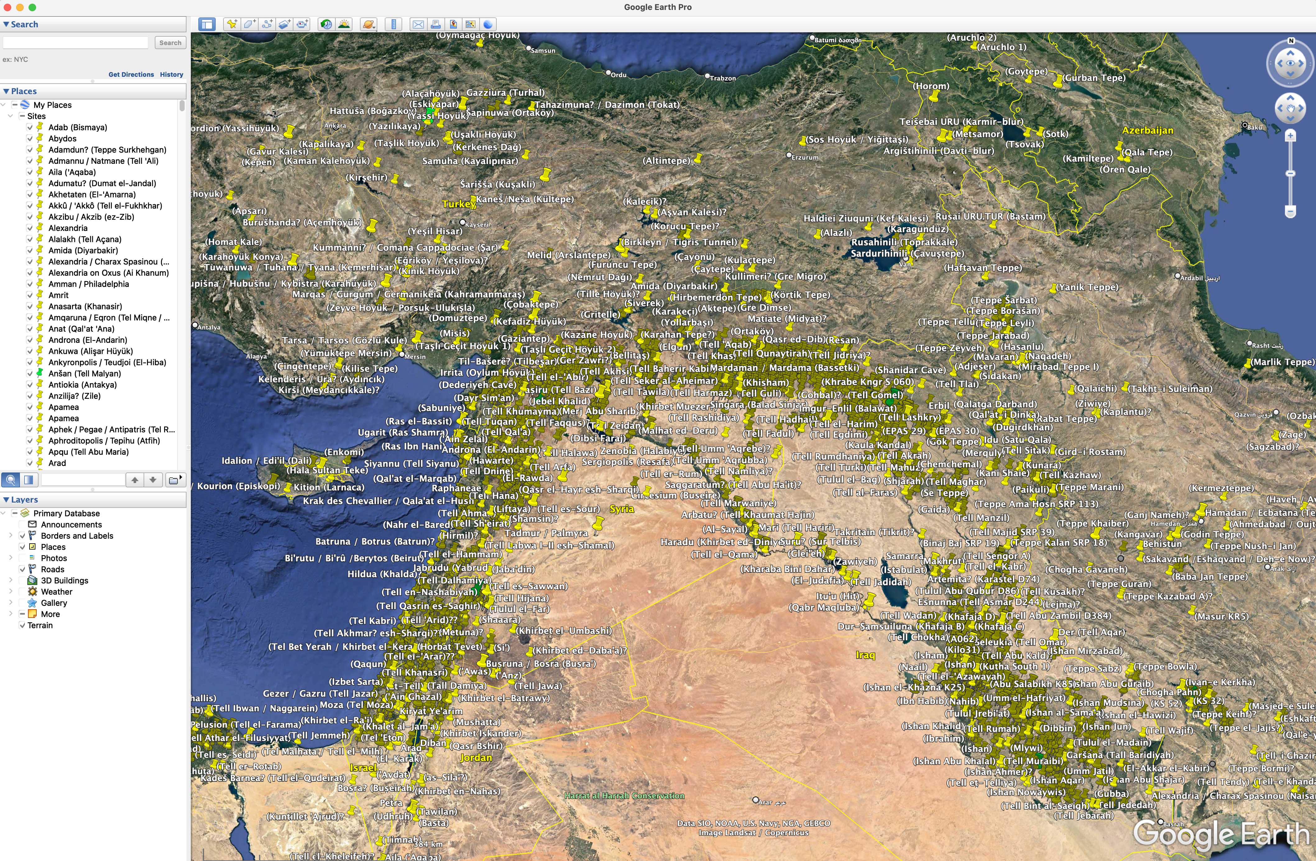
Pedersen, OlofANE.kmz is a set of site placemarks for Google Earth of a selection of the most important archaeological sites in the Ancient Near East. ANE.kmz works with Google Earth Pro, which first has to be downloaded for free. When opened inside Google Earth Pro, ANE.kmz gives, to the left, an alphabetic list of ancient sites and, to the right, on the satellite images the same sites marked. For the moment, there are some 2500 sites with modern names; among them some 400 have ancient names. Additions of more sites are planned. Ancient names are written without parenthesis. Modern names are within parenthesis. Most sites have been identified on the satellite images.
ANE Waters.kmz is an experimental set of provisional water placemarks for Google Earth covering Mesopotamia up to modern time.
ANE Picture.jpg is just illustrating the appearence of ANE.kmz before zooming in and is not for use.
The development started in 2007 with support from Uppsala University, the Urban Mind Project at Mistra, and the Excellence Cluster Topoi at Freie Universität Berlin. Early versions were hosted by Uppsala University servers.Files (2.8 MB)
Name Size ANE Picture.jpg
md5:a08351193be6a503748e73654faa149c1.9 MB
ANE Waters.kmz
md5:3c1c92ccb6324e01d9a882dbc24a89c5460.3 kB ANE.kmz
md5:3c46cf4f2595fe86a1ceaa2146a21c09390.4 kB
And see AWOL's Roundup of Resources on Ancient Geography


 Stumble It!


very interesting information. would you be okay if i use this information in my google maps mash up? ( http://map.belteshazzar.com )
ReplyDeleteThat's what it's there for!
ReplyDeleteIf interested, here's a couple that appear missing:
ReplyDeleteKösk Höyük 37 50'52.99"N 34 36'42.26"E
Can Hasan 37 26'00.43"N 33 32'59.27"E
Nevalı Çori 37 30'46.55"N 38 37'44.15"E
Hacilar 37 35'59.19"N 30 06'00.89"E
Suberde 37 20'59.24"N 31 56'44.51"E